 EMODnet Product Catalogue
Ministry of Finance (Planning Department) (Rahandusministeerium)
Type of resources
Available actions
Topics
Keywords
Contact for the resource
Provided by
Years
Formats
Scale 1:
Resolution
-
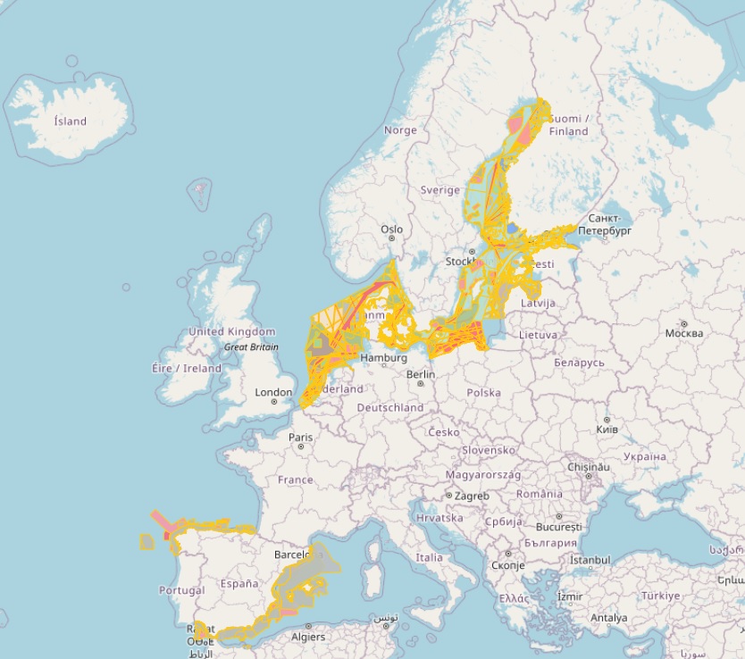
The database on Maritime Spatial Planning (MSP) in the EU was created in 2021 by CETMAR for the European Marine Observation and Data Network (EMODnet). It is the result of the aggregation and harmonization of datasets provided by several sources. It is updated as soon a new plan is adopted by an EU member state and it is available for viewing and download on EMODnet web portal (Human Activities, https://emodnet.ec.europa.eu/en/human-activities). The database contains polygons, points and lines (where available) representing Maritime Spatial Planning (MSP) in the following countries: Belgium, Denmark, Estonia, Finland, Germany, Latvia, Netherlands, Poland, Spain and Sweden. Maritime Spatial Planning (MSP) database is made up of 3 types of spatial features: MSP Spatial Plan, MSP Zoning Element and MSP Supplementary Regulation. Also there is a non spatial feature called MSP Official Documentation. The distance to coast (EEA coastline shapefile) has been calculated using the UTM WGS84 Zone projected coordinate system where data fall in.
-
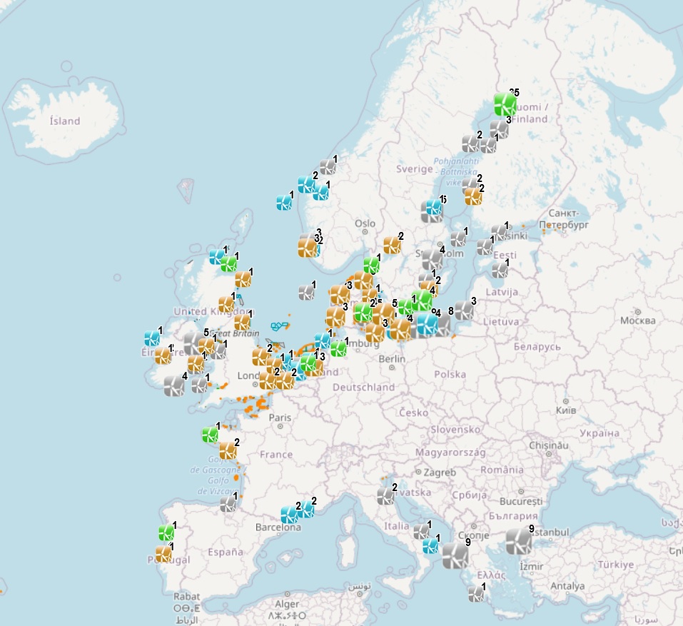
The dataset on offshore wind farms in the European seas was created in 2014 by CETMAR for the European Marine Observation and Data Network (EMODnet). It is the result of the aggregation and harmonization of datasets provided by several sources. It is updated every year and it is available for viewing and download on EMODnet web portal (Human Activities, https://emodnet.ec.europa.eu/en/human-activities). The dataset contains points and/or (where available) polygons representing offshore wind farms in the following countries: Belgium, Denmark, Estonia, Finland, France, Germany, Greece, Ireland, Italy, Latvia, Lithuania, Netherlands, Norway, Poland, Portugal, Spain, Sweden and United Kingdom. Each point and polygon has the following attributes (where available): Name, Nº of turbines, Status (Approved, Planned, Dismantled, Construction, Production, Test site), Country, Year, Power (MW), Distance to coast (metres) and Area (square kilometres). The distance to coast (EEA coastline shapefile) has been calculated using the UTM WGS84 Zone projected coordinate system where data fall in.